

SEARCHING FOR WATER IN SUBSAHARAN AFRICA
Posted on November 19, 2019 at 14:10 by Lydwine Gross
Earth Observation Automatic Quantization
The QuantEO service brings to you all the power of Earth Observation by taking care of satellite remote sensing measurement difficulties.
It simplifies the signal by an automated clustering of Sentinel-2 pixels which allows its users to focus on Earth surface changes.
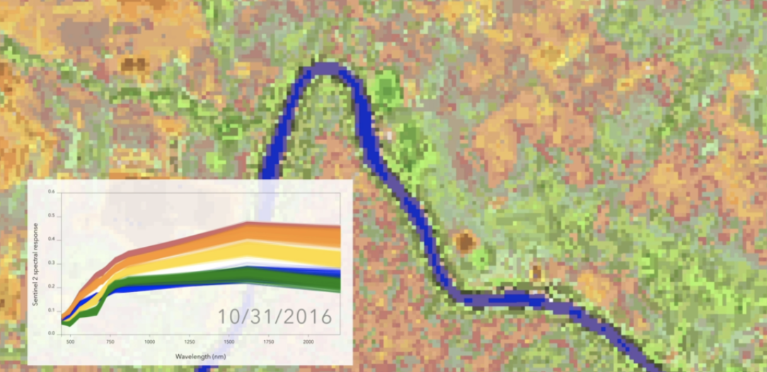
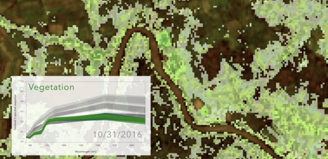
Available via a standard interface, it produces on demand and in close real time classified Sentinel-2 images at 10 meter resolution, in a new space which preserves all properties of Sentinel-2 information (spectral complexity and topology, maximum spatial resolution), and which is consistent over time and from a Sentinel-2 tile to another.
This simplified new space is allowing pixel labelling or grouping by a posteriori classes identification, change detection by distance computation, interpolation, and may be used as a preprocessing step for all kinds of machine learning algorithms.
Request for general conditions and user account: stephane.colzy@pixstart.io.
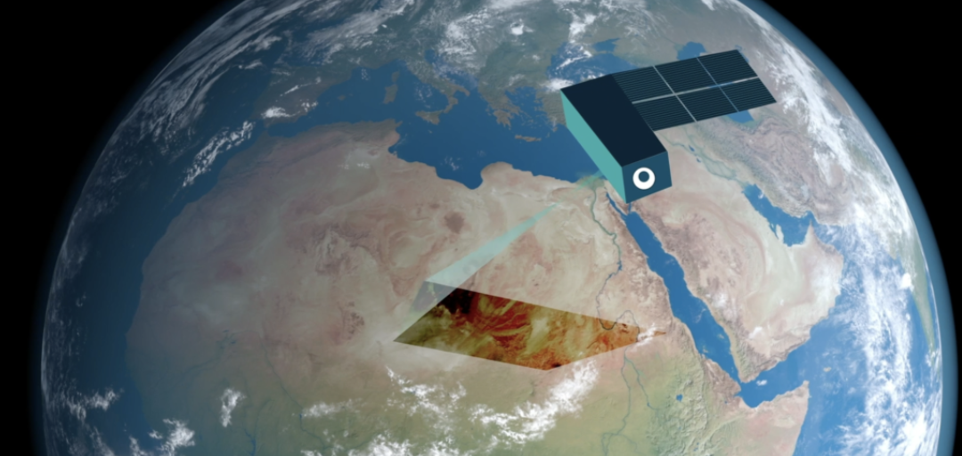
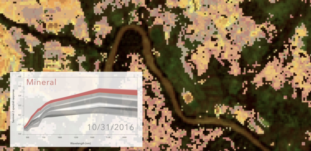
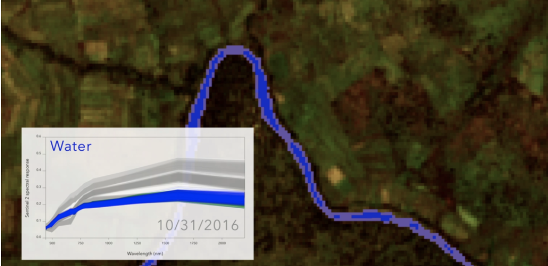
The QuantEO service, developed by Pixstart, classifies each Copernicus Sentinel 2 pixel and produces classification maps that are coherent from a Sentinel 2 tile to another on full eco climatic zones.
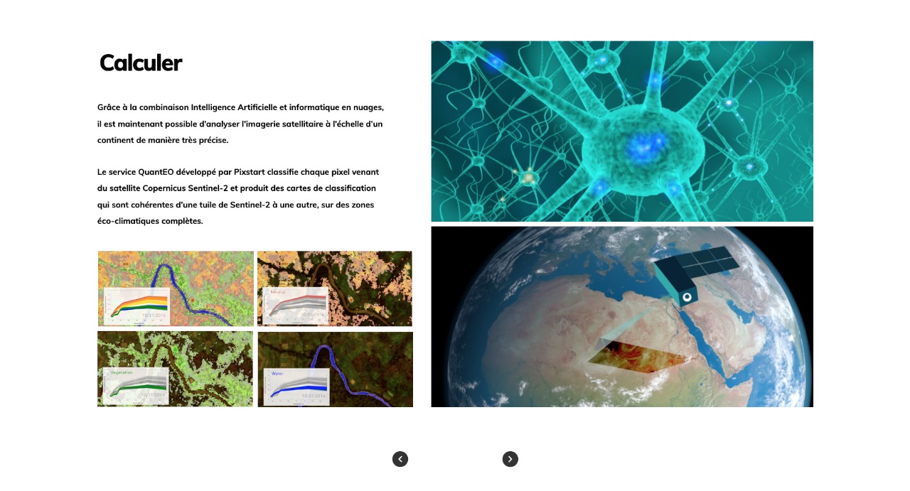
Thanks to the combination of articial intelligence and cloud computing,
it is now possible to analyse satellite imagery on a continental scale very precisely.
Calculate


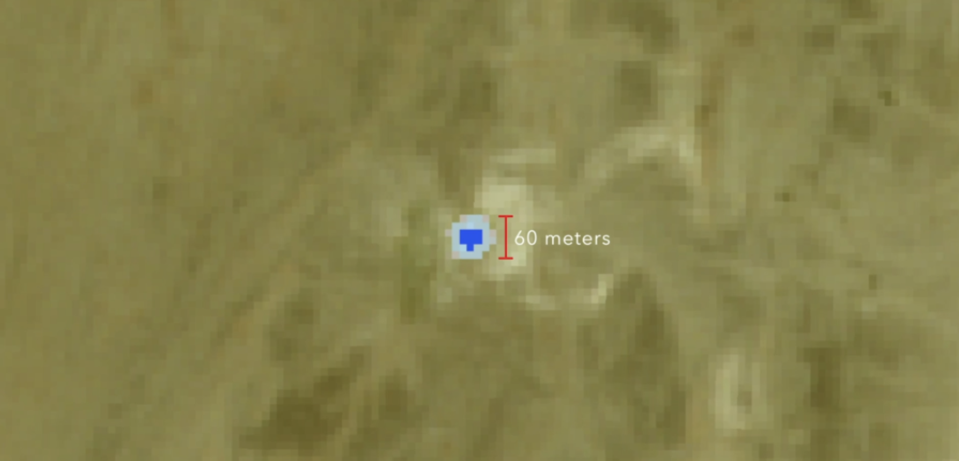
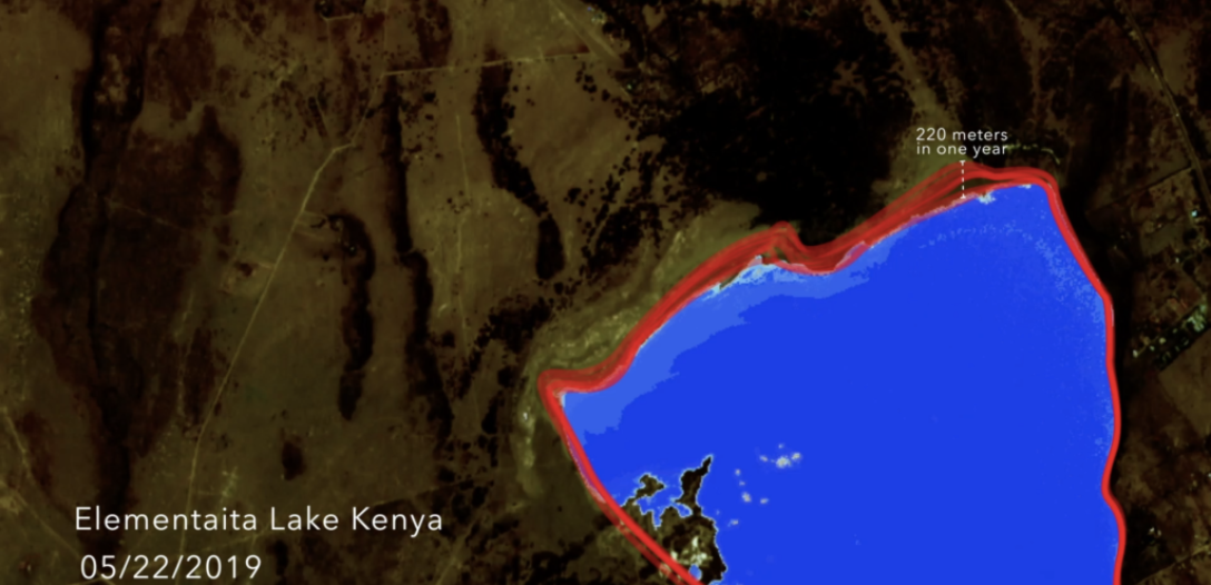
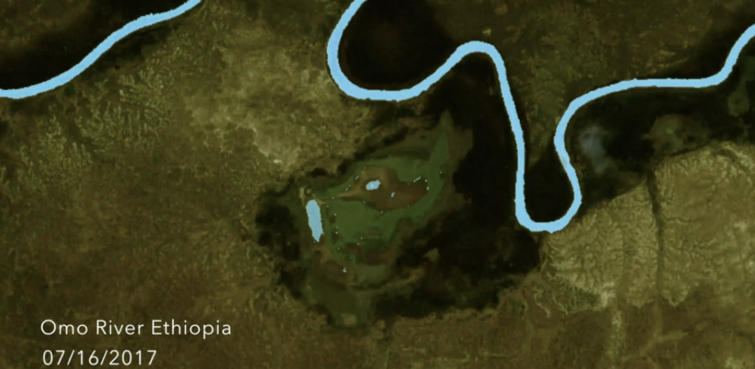
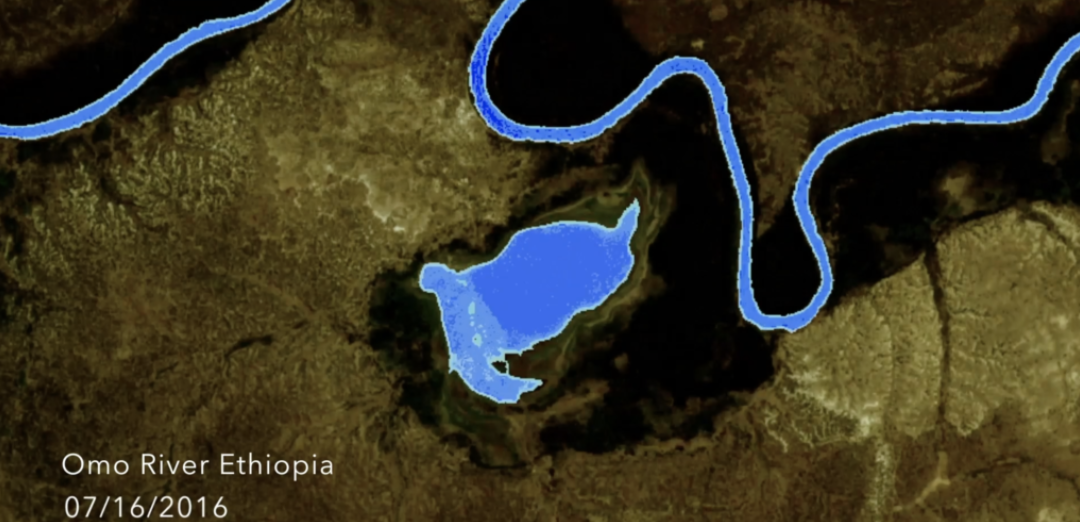
As an example, isolating spectral signatures containing the slightest trace of moisture, it is possible to locate water points and monitor their evolution in order to facilitate their access to the local population, or to help to find water for wild animals, or even to better predict possible movements over vast territories, which drought makes dangerous, and help like for breeders who need to find water during transhumance season.
Analyse
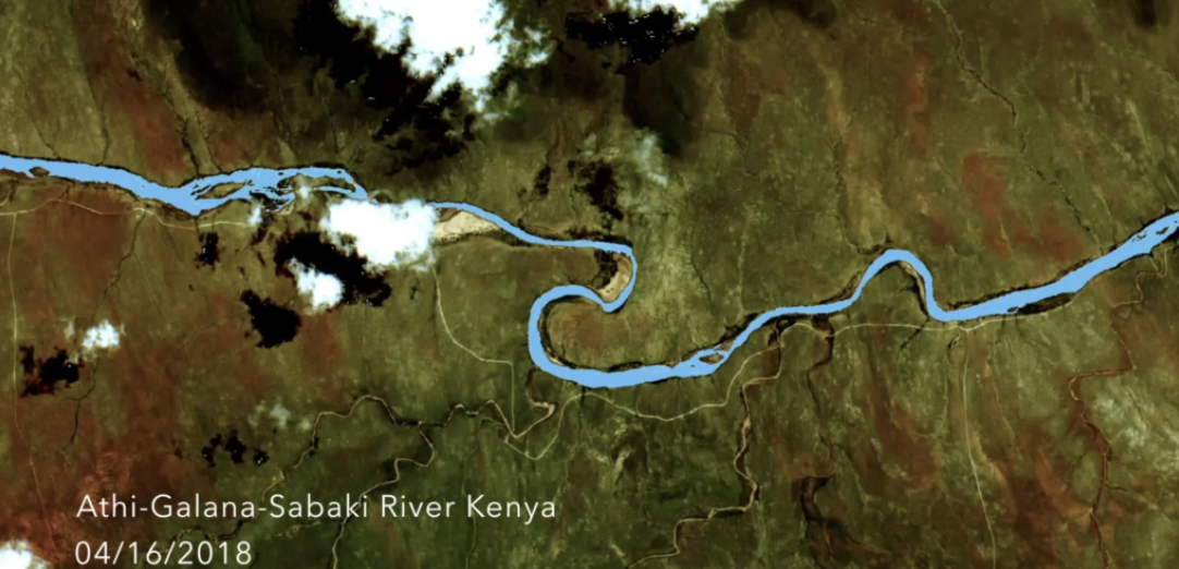
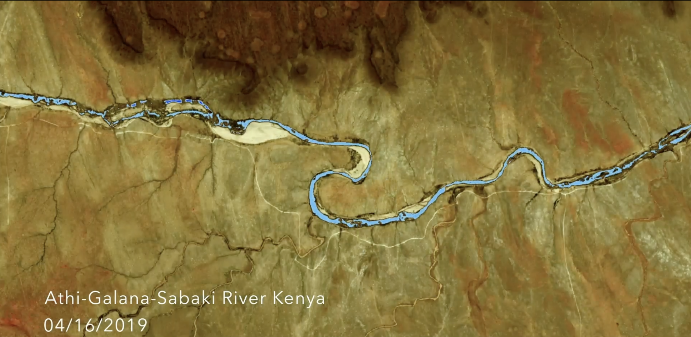
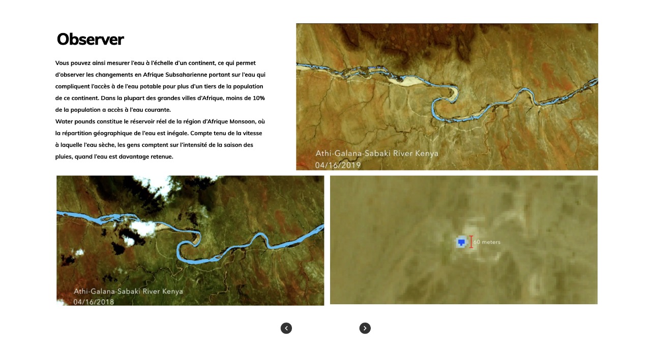
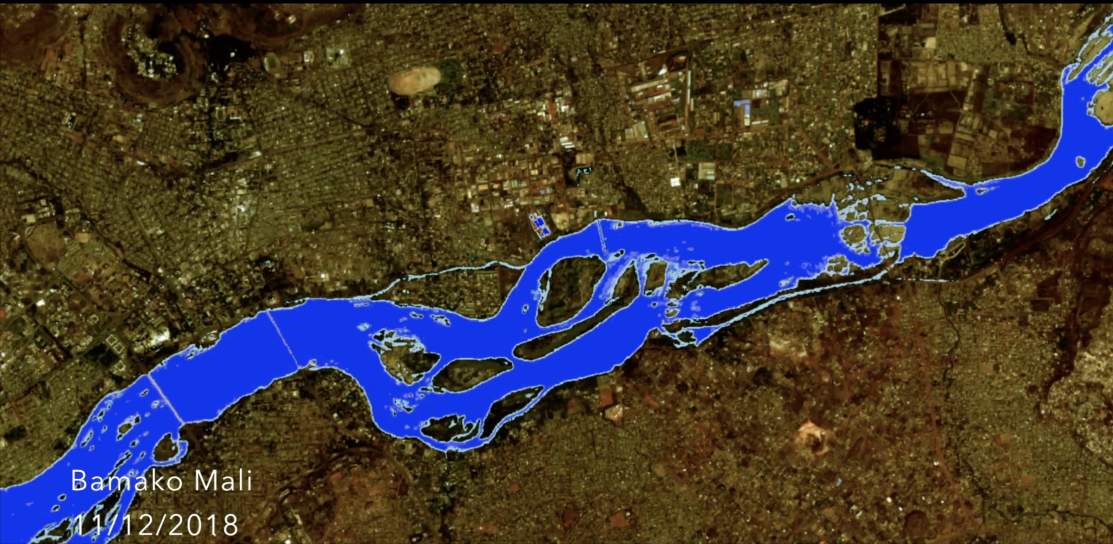
And then you can measure water at a continental scale, which allows you to notice that changes are observed in Sub Saharan Africa concerning water, which are complicating access to safe water for more than a third of the continent’s population. Indeed, in most of Africa’s major cities, less than 10% of the population has access to individual water taps.
Water pounds constitute actual reservoir in the Monsoon Regions of Africa, where the geographical distribution of water is unequal. People rely on rain season strength, where water is retained and how fast it dries.
Observe
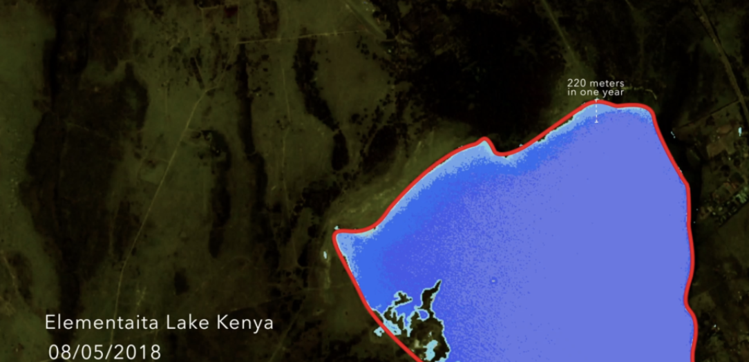
Prédire
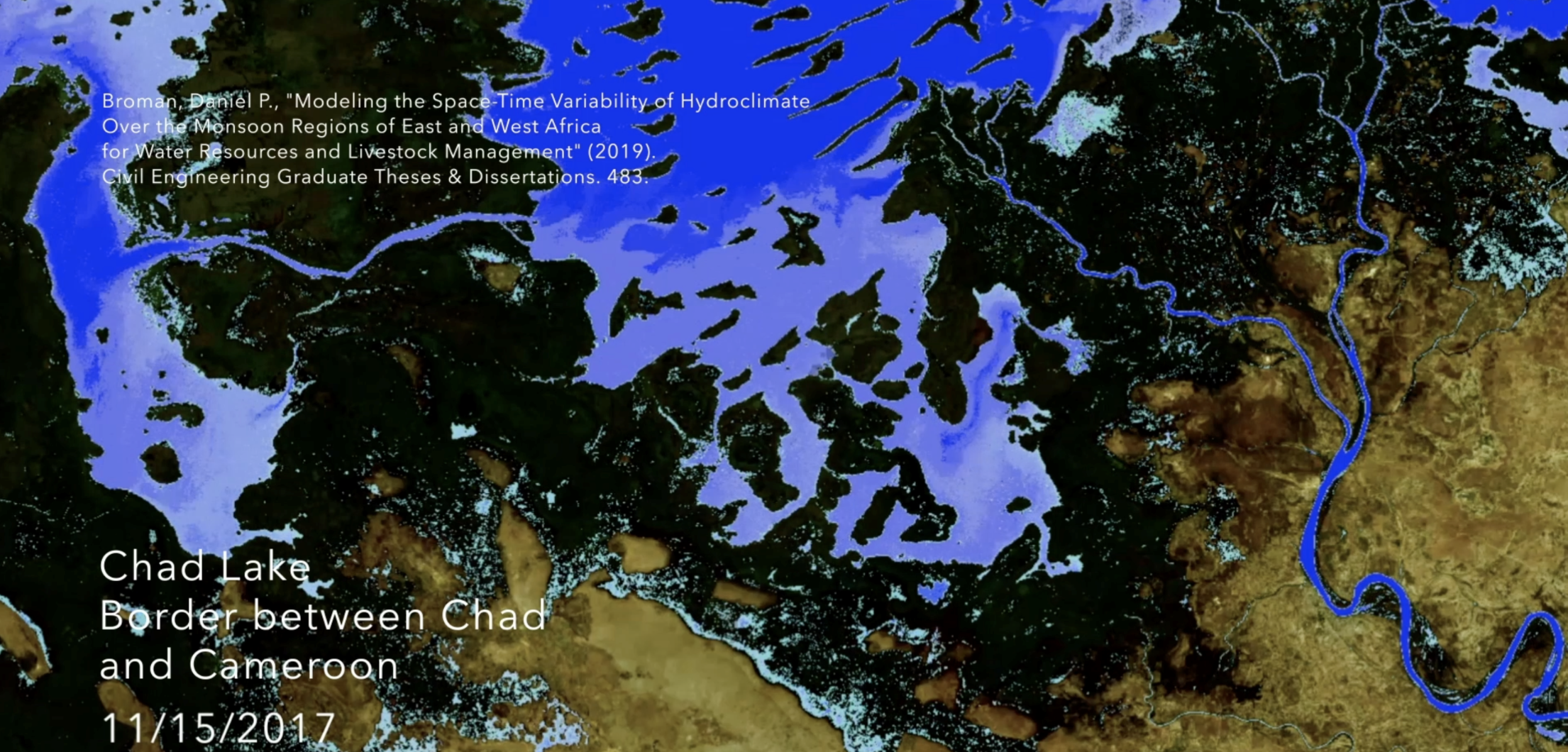
While Chad Lake, an essential resource spread over four countries, has fallen from 25 000 km2 to 1500 km2 in about 50 years, the Sustainable Development Goals released by the United Nation General Assembly of 2015 highlight a need for local, targeted information […] for adaptation to climate change, extreme weather, drought, flooding and other disasters.
Broman, Daniel P., “Modeling the Space-Time Variability of Hydroclimate Over the Monsoon Regions of East and West Africa Resources and Livestock Management” (2019). Civil Engineering Graduate Theses & Dissertations. 483.
Project yourself into the future of Earth and envision your adaption to the global and local situations.

Posted on November 19, 2019 at 14:10 by Lydwine Gross